
About VenturePin
VenturePin is a powerful personal mapping platform that empowers outdoor enthusiasts to record, organize, and display their custom points of interest and routes. Create your personal adventure database with advanced mapping features, weather overlays, and comprehensive customization options.
Core Features
VenturePin combines powerful mapping technology with intuitive design to create the ultimate personal adventure recording and display platform.
POI Import & Photo Data Extraction
Import points of interest from multiple file formats (GPX, KML, CSV) with automatic photo data extraction. Features an intuitive file upload interface with "Choose File" functionality and "Upload and Import" processing. Build your personal location database with rich metadata and visual documentation of your adventures.
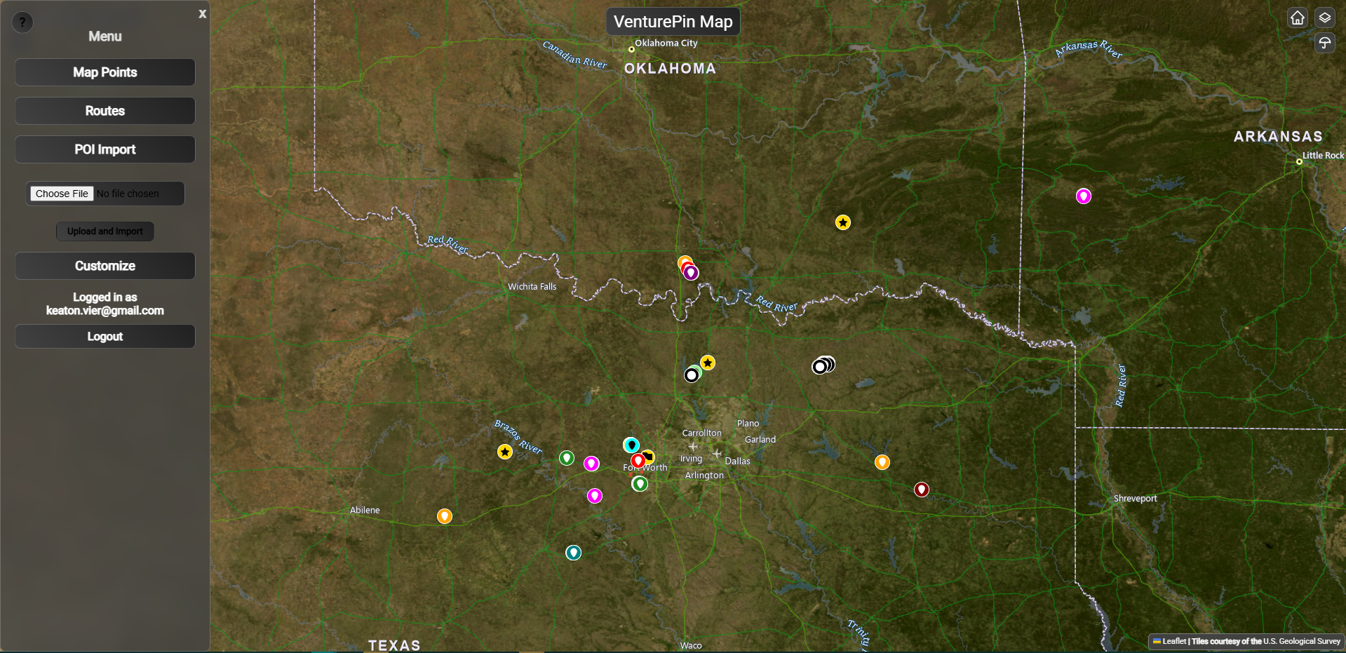
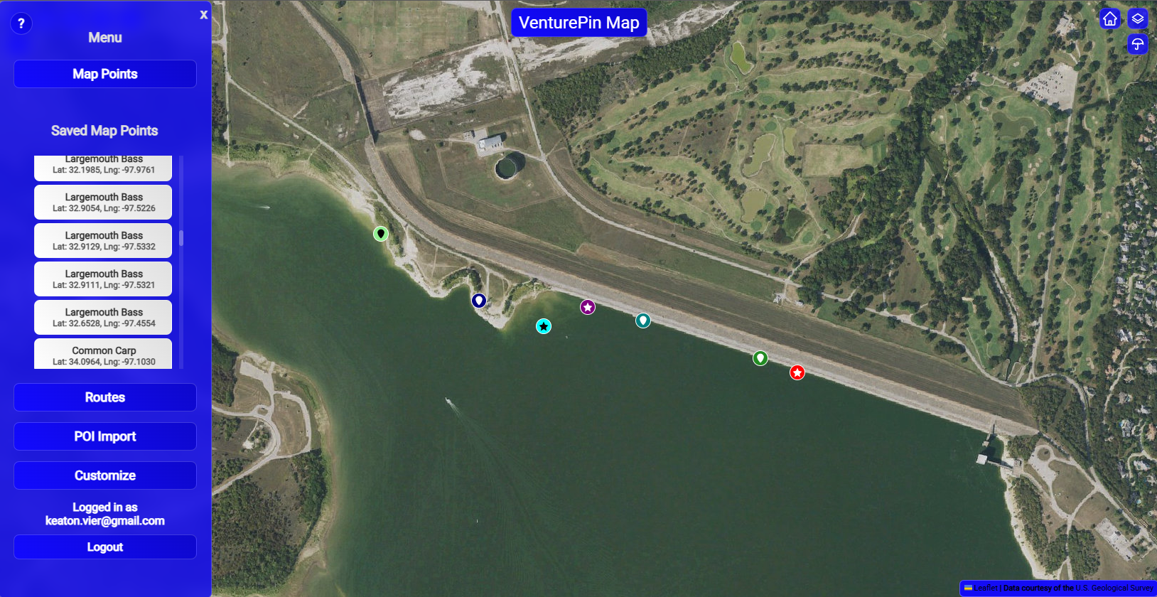
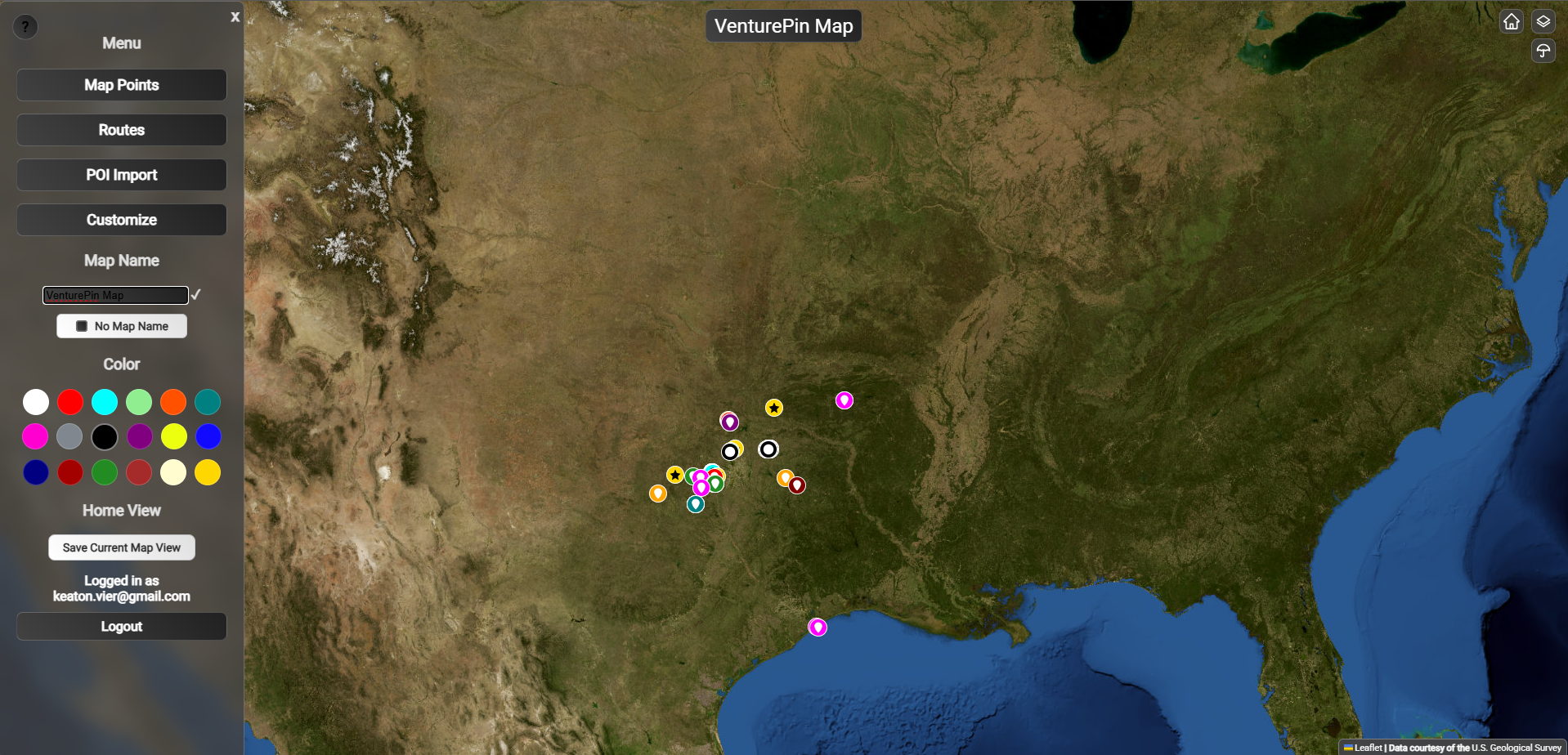
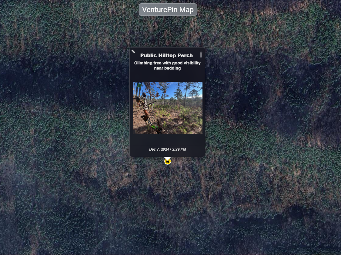
Personal POI Management
Create, edit, and organize your custom points of interest with detailed descriptions, photos, and categorization. Build your personal adventure database with unlimited custom markers and waypoints. Features colorful pin categorization with circular and star-shaped markers in various colors (pink, yellow, white, teal, purple, orange) for easy visual organization.
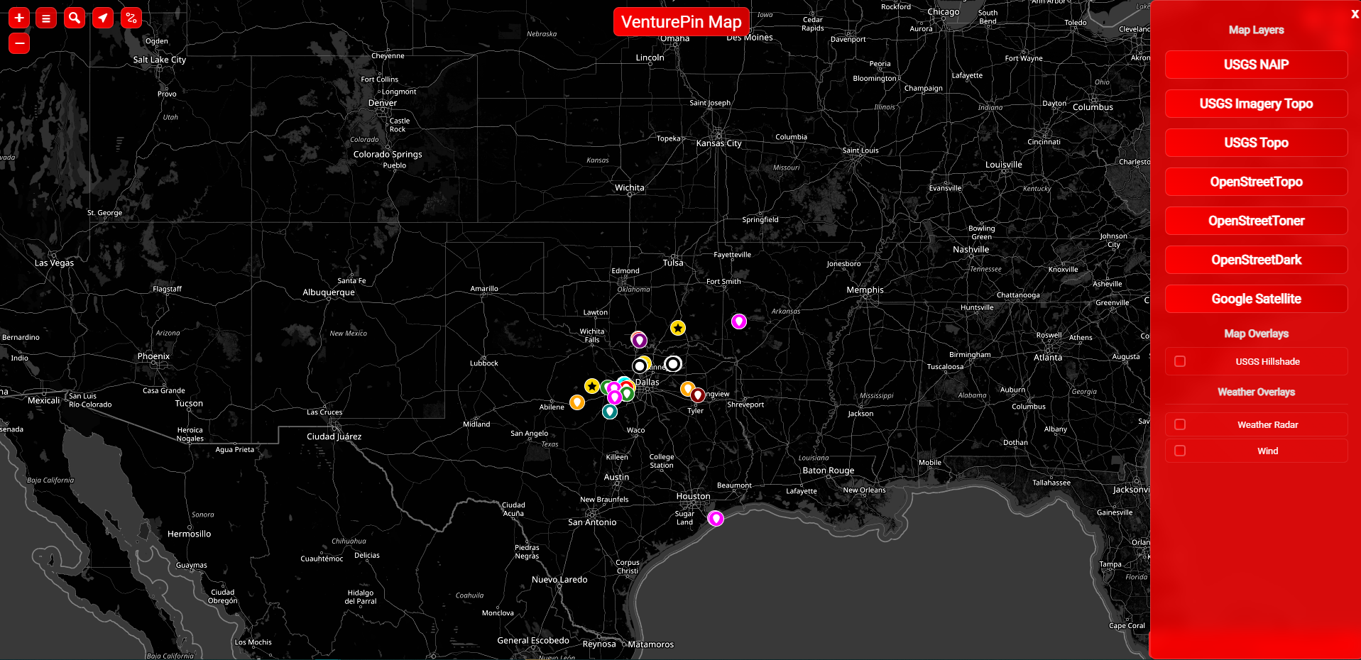
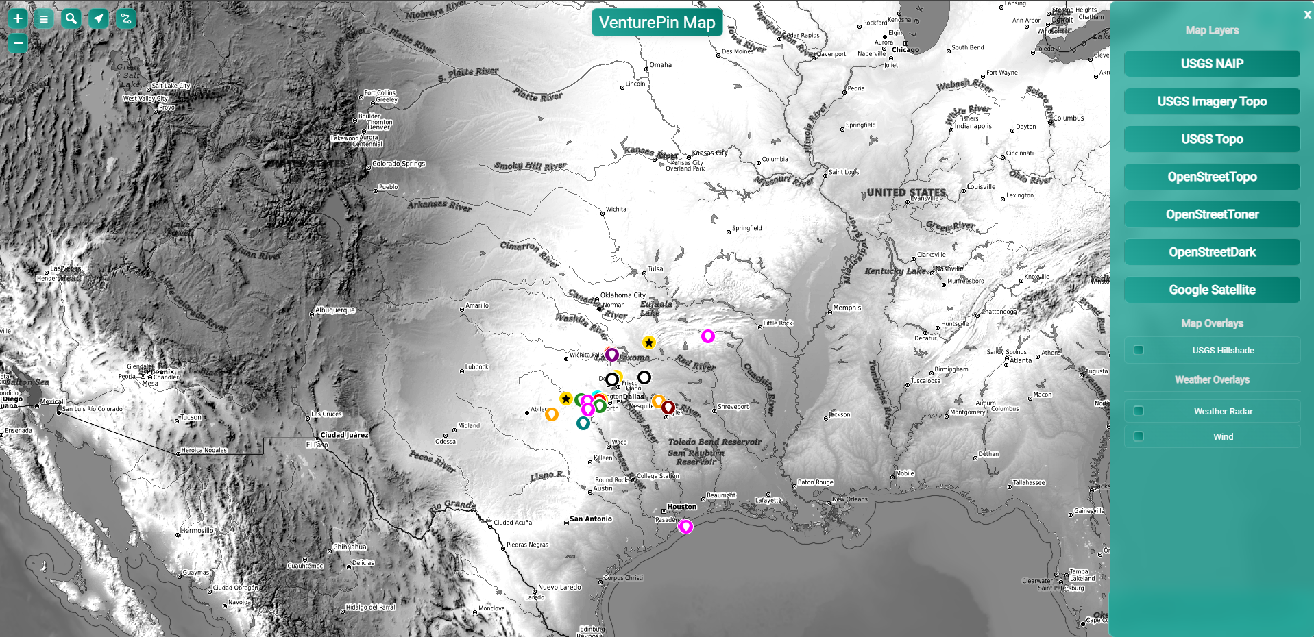
Advanced Map Layers
Comprehensive map layer options including USGS NAIP, USGS Imagery Topo, USGS Topo, OpenStreetTopo, OpenStreetToner, OpenStreetDark, and Google Satellite for high-resolution imagery. Switch between layers seamlessly with an intuitive sidebar interface to find the perfect view for your adventure planning.
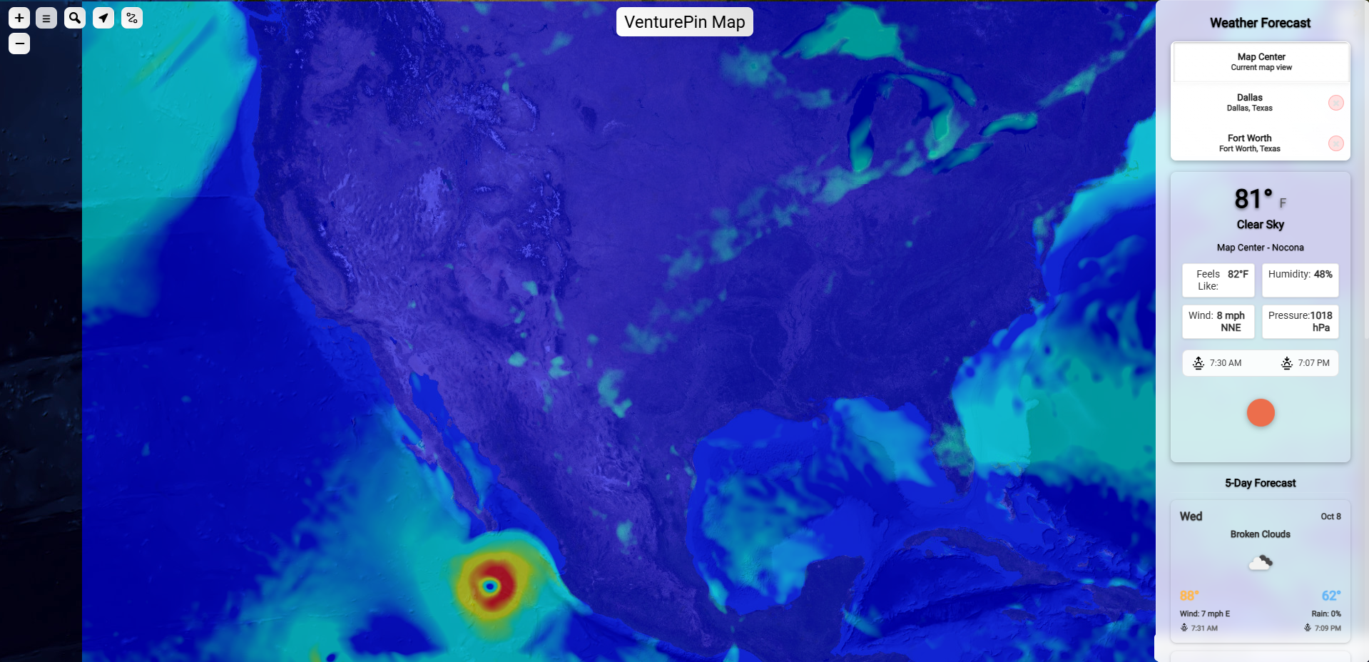
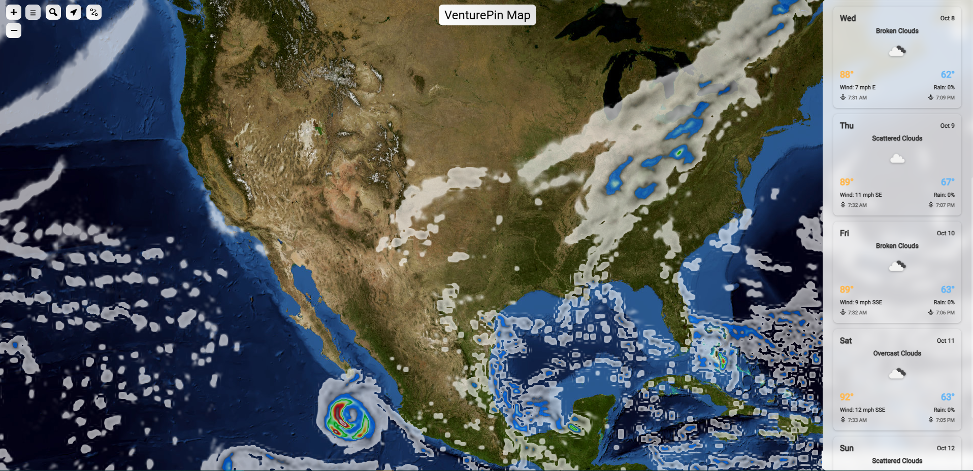
Weather Overlays & Forecasts
Advanced weather visualization with real-time radar, cloud cover, precipitation, and even tropical storm tracking. Features a comprehensive forecast panel showing current conditions (temperature, humidity, wind, pressure), sunrise/sunset times, and detailed 5-day forecasts for any location on the map.
Complete Customization
Personalize your mapping experience with an extensive color palette featuring 18 color options (white, red, cyan, light green, orange, teal, magenta, grey, black, purple, yellow, blue, dark blue, dark red, dark green, brown, cream, gold). Customize map names and save your preferred home view settings for instant navigation.
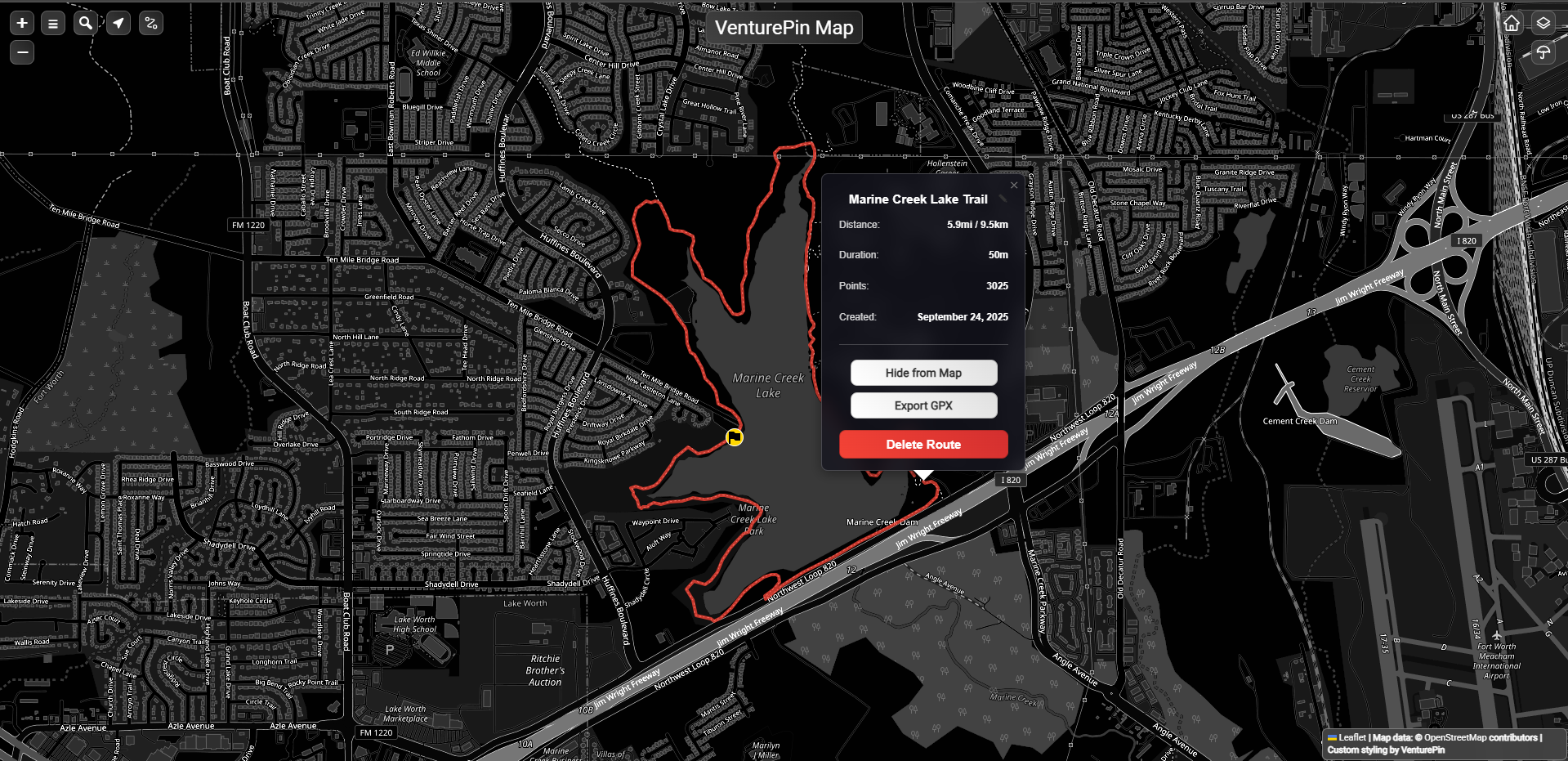
Route Recording & Display
Record your routes in real-time with precision tracking. Features detailed route information including distance (5.9mi/9.5km), duration (50m), and high-resolution data points (3025 points). Manage routes with options to hide from map, export in GPX format for compatibility with other devices, or delete routes. Perfect for tracking adventures like the "Marine Creek Lake Trail" shown.
Advanced Mapping Features
Professional-grade mapping tools for serious outdoor enthusiasts and adventure recorders.
Precision Location Tracking
High-accuracy GPS tracking with support for multiple coordinate systems and precision settings for professional-grade location recording.
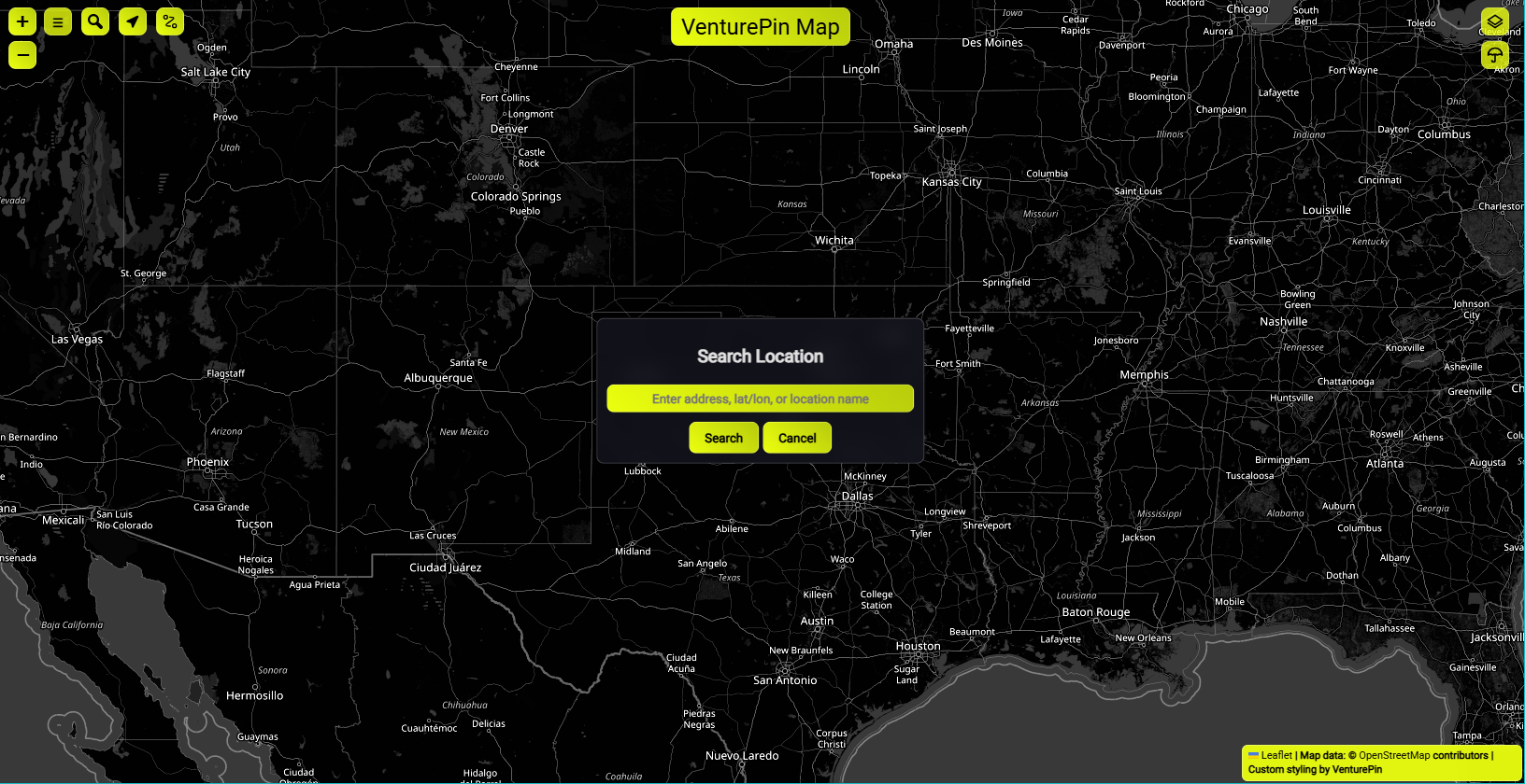
Advanced Search & Filtering
Powerful search and filtering capabilities to quickly find specific POIs, routes, or locations within your personal adventure database.
Custom POI Editing
Edit your points of interest with custom titles, detailed descriptions, personalized map marker icons, and custom colors to create a truly personalized adventure database.
Cloud Sync & Backup
Secure cloud storage with multiple login options including email, Google, and Apple authentication. All your adventure data is automatically saved to the cloud and accessible across all your devices.
Detailed Weather Forecasts
Comprehensive 4-day weather forecasts with detailed information including high/low temperatures, wind speed and direction, rain percentage, sunrise/sunset times, and weather conditions for precise adventure planning.
Who Uses VenturePin?
From weekend adventurers to professional outdoor guides, VenturePin serves a diverse community focused on recording and organizing their personal outdoor experiences.
Hikers, Backpackers & Mountain Climbers
Record trail markers, document scenic viewpoints, build a personal database of hiking routes, and track climbing routes with summit coordinates and weather conditions.
Runners & Cyclists
Track running and cycling routes, record performance metrics, and catalog favorite paths and challenging terrain for both sports.
Campers & RVers
Catalog camping spots, record road trip routes, and build a personal database of favorite outdoor destinations.
Fishing Enthusiasts
Mark productive fishing spots, record catch data, and document seasonal patterns for personal reference.
Hunting Enthusiasts
Mark hunting locations, track game patterns, record successful spots, and document seasonal hunting areas for future reference.
Commercial Applications
Tour guides and outdoor instructors use VenturePin to organize client routes and maintain professional location databases.
Technical Specifications
Built with modern web technologies for optimal performance and reliability.
Web-Based Platform
Fully functional web application accessible from any device with a modern browser. No downloads required.
Mobile Apps Coming Soon
Native iOS and Android applications currently in development for enhanced mobile experience.
Cloud Integration
Secure cloud storage with automatic synchronization across all your devices and platforms.
Privacy Focused
Your personal adventure data remains private and secure with enterprise-grade security measures.
Media Assets
Download high-resolution assets for press coverage, social media, and marketing materials.
App Screenshots
High-res screenshots of key features and interfaces
Logo & Branding
VenturePin logos in various formats and sizes
Feature Graphics
Visual representations of key app features
Demo Videos
Short videos showcasing app functionality
📥 Download Media Kit
Complete press kit with all assets, fact sheet, and brand guidelines
Contact
For press inquiries, partnership opportunities, or general questions about VenturePin.